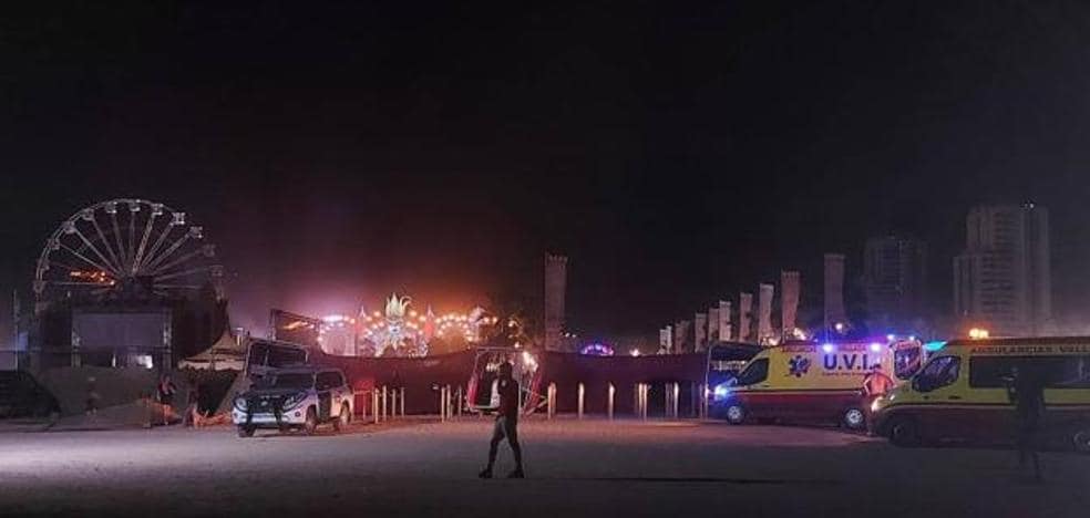
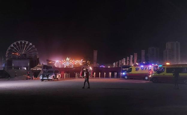
The strong gusts of wind caused the structures of the enclosure to collapse, which has caused the death of one person and several injuries.
During the night of this Saturday a strong gust of wind has caused the collapse of the stage of the Medusa Festival in Cullera (Valencia) and has caused one death and 17 injuries of varying degrees. According to Aemet, there have been “warm outbursts” with “very strong wind gusts and sudden rise in temperature”, probably of the so-called “convective”.
In a thread on its Twitter account, the agency explains that in the early hours of the night there were storms in Albacete and the Region of Murcia that were moving eastward, first reaching the Alicante coast at around 2:00 and two hours then that of Valencia.
The storms brought precipitation and some lightning inside but, as they approached the coast, the rain dissipated and there were hardly any lightning strikes. In fact, on the coast it has practically not rained or there have been weak showers.

Aemet details this phenomenon and why it occurs: the atmospheric profiles that give rise to hot bursts are “all very similar”. “They are said to be onion-shaped boreholes, with relatively cool, moist air next to the ground and an extremely dry, warm layer a few hundred meters above.” In the case of the Alicante-Elche airport, at 2 in the morning, this phenomenon has caused it to exceed 40 degrees and a gust of 80 km/h.
The other wet layer, which would be the base of the cloud, was “very high”, at more than five kilometers altitude, which was saturated between 5,800 and 6,500 meters altitude. The base of the cloud was therefore very high and below it was a very dry layer more than four kilometers thick.
The precipitation that occurs at the base of the cloud, which is very high, evaporates in the lower dry stratum; as the air evaporates it cools and becomes denser than the surroundings; as it becomes denser it begins to descend and accelerate.
The strong downdraft is produced primarily by evaporation of rain and melting and sublimation of hail below the cloud base. For this reason, he explains, on the coast it has not rained or it has been very light, because the precipitation evaporated long before reaching the ground and that evaporation cooled the air, which is what descends and causes the blowout.
With the descending air, in that descent it “accelerates” and, if there is no thermal inversion, it hits the ground causing strong gusts, but not a rise in temperature. This is a dry blowout, which has occurred in Xàtiva, for example, with gusts of 84 km/h.
But if, on the other hand, there is inversion next to the ground (cool and humid air), on its way down the air can cross the cool layer, causing the intrusion of warm air above it. In the area where the descending air crosses the inversion, there is a sudden rise in temperature and, in fact, the theoretical model predicted temperatures of up to 40 degrees, as has happened.
Crossing the humid layer is in fact a “brake” for the air that descends from more than 5 km of altitude, but if the inversion is very shallow, as it was this morning, “the speed is sufficient to cross it and reach the ground with very strong speeds.
The blowouts have been generalized, in some cases there have been no strong gusts, because the inversion was very high and the air reached the ground very slowly, in others the inversion has not broken but the temperature has risen due to the compression of the lowest stratum .In the most adverse cases, strong gusts of wind and sudden rises in temperature have occurred locally in some localities due to these hot bursts.
#hot #blow #main #accident #Medusa #festival