
On September 1, 1983, Korean Air Flight 007 took off at 1:00 p.m. from Anchorage Airport in Alaska, USA, en route from New York to Seoul, South Korea. 246 passengers and 23 cabin crew were traveling inside. The commander set the autopilot to constant magnetic bearing, but with an error that sent the aircraft further north over the Kamchatka Peninsula, crossing the cold Sea of Okhotsk over Sakhalin Island, and heading straight for the Soviet fleet base on the Pacific, Vladivostok. Ignoring his situation, the pilot was surprised to see a fighter suddenly cut his course and position himself right next to the cockpit.
There were still six years to go before the collapse of the Soviet Union, and the Cold War was going through one of its tensest moments. The Soviet command had sent two Su-15 and two Mig-23 fighters to intercept the Korean plane. “I could see two rows of windows, which were illuminated,” the Soviet pilot, Col. Gennadi Osipovitch, said in a 1998 interview with CNN. “I was wondering if it was a civilian plane. Military cargo planes don’t have those windows. I wondered what kind of plane it was, but I didn’t have time to think. I had a job to do. I started to point out [al piloto] in international code. I informed him that he had violated our airspace. He did not answer”. Two missiles ripped apart the commercial airliner, sending the remains of its casing into the frigid water. All passengers and crew died instantly. The tragedy shocked the world and strained the already difficult relations between the US and the Soviet Union – a US congressman was traveling on flight 007 KA.
As a consequence, US President Ronald Reagan, in order to prevent similar tragedies in the future, made a decision that changed the world as we know it. He made available to the public, and free of charge, a military technology that had given the Americans the strategic advantage to date: GPS. With this navigation system, Flight 007 KL would have reached Seoul without deviating from its route.
A global positioning system that, curiously, was conceived with another Soviet action: the launch of the Sputnik satellite in 1957. Researchers at MIT (Massachusetts Institute of Technology) warned that the frequency of capturing the beeps emitted by the Russian satellite decreased as it was moving away (by the Doppler effect), and that this phenomenon could be used to determine the location, speed, route and elevation of any vehicle on the earth’s surface. In 1959, the US Navy already had its Transit system, the forerunner of GPS.
What is GPS?
GPS technology currently moves more than 85,000 million euros. If tomorrow it failed, the banks would collapse, commercial air, land and sea shipping would be paralyzed and the great grain crops could not be harvested. It is the world clock with atomic precision. Until the year 2000, the civilian population did not have a totally free GPS, but today they are the eyes of our society. For this reason, both Russia, with its Glonass system, and the European Union, with Galileo, have their own satellite navigation systems.
The GPS (Global Positioning System) system is maintained by a small detachment of US Air Force technicians, known as Team Blackjack, who operate 31 satellites from Schriever Air Force Base in Colorado. The satellites circle the earth twice a day in fixed orbits, at a speed of 11,000 kilometers per hour and at an altitude of 19,300 kilometers, and emit signals 24 hours a day that are picked up by GPS receivers. Through trilateration (the receiver measures the distance to each of the satellites captured by the amount of time), the GPS device can inform the user of its exact position on the planet. The more satellites the device picks up, the more reliable its measurement of latitude, longitude, altitude, time, and speed en route.
With the arrival of smartphones and their multiple applications, this system has expanded in such a way in leisure, work and mobile applications that it has simply become an invisible routine. We are hardly aware of its use.
What can GPS do besides tell you where you are on your travels?
It is your first time in Bangkok and you want to go to the Royal Grand Palace from your hotel. Almost without thinking, search the application Google Maps on his cell phone and it turns out it’s no more than a 10-minute walk away. If it’s not a hot day in the Thai capital, instead of taking a taxi or a tuk-tuk He decides to walk quietly, he knows he is not going to get lost. The most obvious function of GPS, the one used on a daily basis, especially on trips, is navigation between two points. But it has many others.
- Connect with the environment. Thanks to GPS you can know not only where you are going, where you are going and how long it will take to get there, you can also receive practical information such as the location of hospitals, police stations, hotels and, of course, the best rated Thai restaurants on the web.
- Stay in touch with the group. To continue with the example, you may want to meet inside the huge palace complex in Bangkok with a travel companion. WhatsApp, for example, it allows you to share your location in real time with one or more people, for up to eight hours, if you activate the function Send location in real time. This is especially useful when going on a hiking or cycling route with a very heterogeneous group and you need to know the situation and the estimated time of arrival of each one of the members.
- Travel safer. WhatsApp real-time location is a wonderful tool to stay in touch and be located. Other mobile applications, such as CAIRNthey can also send route start and end messages, manage the battery so that it does not run out during navigation and inform of its reservation, or send “I’m still fine” messages to family and contacts in outdoor conditions where there is no There is cell phone coverage.
- Know where the children are. The GPS can give you a plus of security thanks to the locators. AngelSens, for example, is a device that was developed for children with special needs and is currently used to monitor their activity and location and communicate with them in an emergency. There are also collars with GPS locators for dogs and cats. In fact, with locators it is also possible to control the location of your ski boards or your bicycle, in case of loss or theft.
- Receive alerts well in advance. If after your stay in Bangkok you decide to travel to the south of Thailand, you may be interested in downloading the application Tsunami Warningso as not to live an adventure The impossible. The program monitors earthquakes and tsunamis around the world, and alerts its users by SMS, voice and email. Thanks to the GPS receivers installed on the ground, the authorities can determine the epicenter of an earthquake, its magnitude and if it is going to produce a tsunami, in order to warn the population likely to suffer the consequences well in advance.
- Ask for help even unconscious. It can also be used as a passive security element, in which you do not have to be aware of the mobile. For example, him EVO21 smart helmet for cyclists detects falls of the cyclist and, if after 90 seconds, there is no user activity, it sends an SOS to the selected mobile contacts with the precise location. A fantastic feature, especially when you have an off-road accident and visibility is poor.
Smart phone or GPS device?
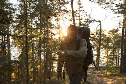
Both mobile phones and wrist watches smart watch they work as excellent browsers, although they differ from the Garmin-type GPS devices in that their system is usually A-GPS (assisted global positioning system) and they do not connect directly with the satellites, but rather collect information from the repeaters or the WiFi network. As long as you use the GPS functions in an environment with enough coverage, such as cities, the mobile will give you a good service. The problem comes when traveling to remote regions, where phone companies do not usually have users.
In such circumstances, a GPS device that contacts the satellites directly will be more reliable. Of course, the accuracy of the device will depend on atmospheric conditions (clouds interfere with satellite signals) and the relief and vegetation of the environment (forests, large peaks, etc.). But in general, GPS devices will be a better choice if your trip takes place in open air and sparsely inhabited areas: they are more resistant to inclement weather such as dust or rain, at low temperatures they do not discharge the battery, abroad it can be a much cheaper way of browsing than mobile and, in case it is of interest to you, your browsing is private.
Subscribe here to The Traveler newsletter and find inspiration for your next trips in our accounts Facebook, Twitter and Instagram.
#fascinating #history #GPS #military #invention #changed #travel #find #restaurant #field


/cloudfront-eu-central-1.images.arcpublishing.com/prisa/RLPF77Z7ERDPFFSKEKIAA4SMIA.jpg)

