We are increasingly controlled and this is taken for granted in the new digital age where everything passes through a network to which we leave our data, even sensitive data, every day: 360° controls!
Now come the drones to support control activities, because they are able to provide a detailed aerial view of the affected area. Drones can be used to monitor the safety of infrastructures, such as bridges, dams, roads or highways, providing real-time information on structural integrity or any anomalies.
Road surveillance drones
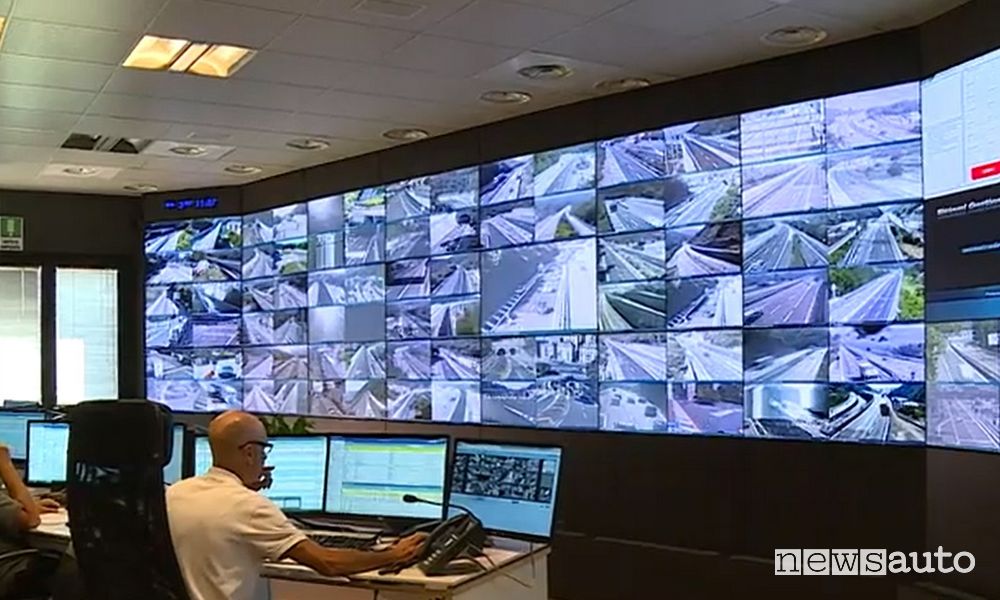
About using road surveillance drones the experimental program is interesting”Falcon” of the Autostrade per l’Italia group which, through the use of dronesallows you to send video streams in real time directly to Information Radio Centerallowing you to monitor the status of the viability even in stretches of motorway where they are not available cameras.
A unique initiative in Italy, launched in the area Ligurianboth for the number of hours in flight and for the characteristics of the experiment, which envisaged the execution of night flights and the monitoring of exceptional transits also at construction sitesalong some stretches of the A26 and of A10. With this technology Aspi intends to support the current system of cameras and sensors for traffic monitoring.
Drones for highway inspections
The Falco program, that is drones on the highway falling within the wider Mercury program, was divided into about ten days, in which the flight activation of the drones took place both in a scheduled and occasional way: there were over 60 km of motorways flown over5 drone models tested, 26 different targets monitored and 79 flights performed, for a total of about 16 effective hours, of which over 3 at night.
The results obtained after the first design phase were shared with ENAVwhich provided useful insights for identifying further technical and operational improvements, already implemented in the next phases of the project.
During the flights, in addition to the road conditions, it was possible to observe the work sitesroad signs, the exact extension of the queues, the condition of the pavement and greenery.
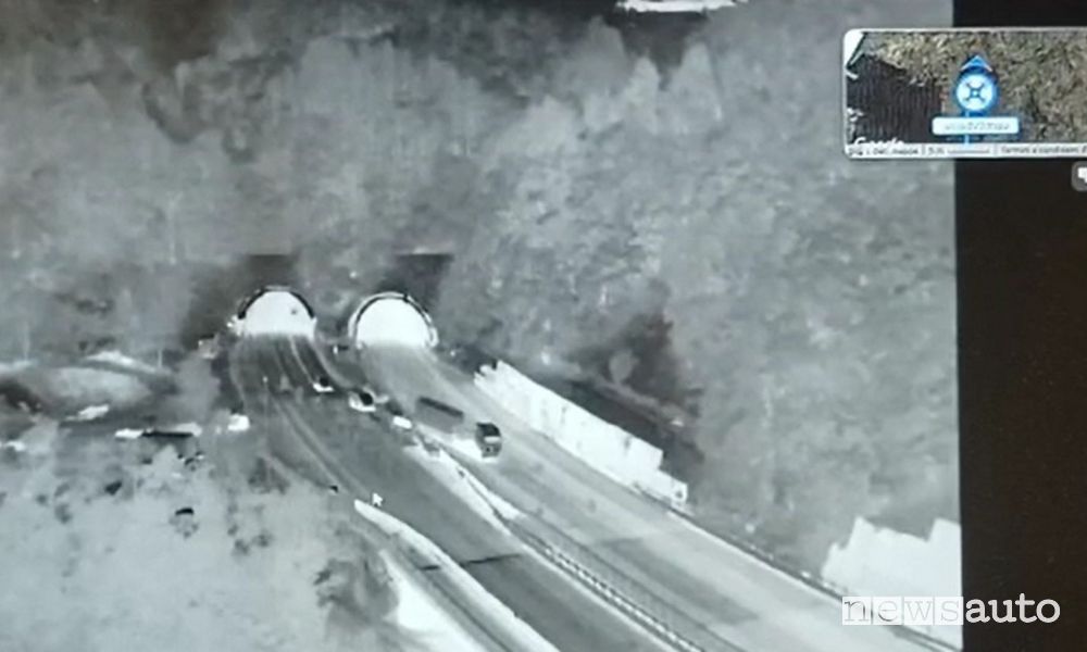
During flights nocturnal, thanks to the use of integrative technologies such as thermal and infrared camerasparticular operating conditions have been observed such as the activation phases of a work site and the transit of exceptional transport.
Real-time traffic from the drone
In the first phase of the “Falco” trial, the drones were flown on sight by field operatorswhile in the second phase scheduled for this summer, the remote piloting and drones capable of performing will be introduced monitoring missions along predefined routes in automatic mode.
For this reason, a layout consisting of “nests”, already installed to house the drones and allow them to fly over the assigned section of the A26 from the A10 junction to Ovada, and on the A10 between the connection with the A26 and Varazze.
Skytraffic drone to monitor the highways in Veneto
Other use of drones to monitor highway infrastructure is that of Venetian motorways, Venetian motorway concessions, Skytrafficwhich they explored, with the collaboration of the Drone Network Company FSO Italysince last year, the use of drones for the security of infrastructures through fleets of autonomous aircraft (drones) piloted remotely.
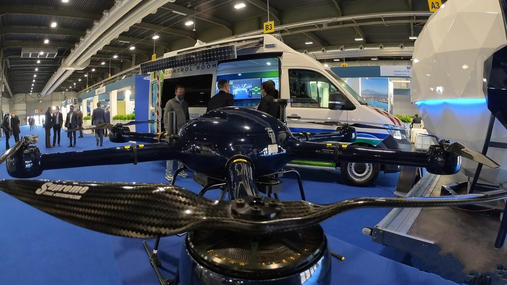
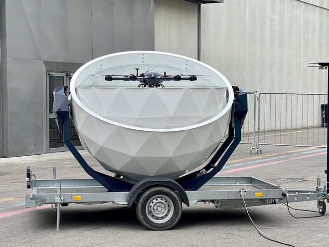
Definitely revolutionary, innovative and totally Made in ItalyThe NEST for the transport and take-off of the drone without the need for a pilot physically present on site, controlling all the functions of the device from a remote operations room, even hundreds of kilometers away.
Can the drone fly on roads or highways?
In principle, drones cannot fly on roads and highways, unless there are specific permits and regulations that allow it. In general, drones are subject to spatial and altitude restrictions, and using a drone on roads or highways could pose a potential threat to the safety of vehicular traffic and people.
In some countries, such as the United States, there are strict regulations for flying drones that require them to fly a minimum distance of 5 miles (about 8 kilometers) from any airport and may not be flown over people, private property or moving vehicles. Furthermore, there are restrictions on the night flight of drones, the maximum distance from the pilot, the maximum flight altitude and the presence of identification and georeferencing devices.
In any case, if you want to shoot with the drone on roads or highways, it is important to obtain the necessary authorizations from the competent authorities and to comply with all current regulations regarding drone flights. For more information on where a drone can fly, read the ENAC FAQ.
You may also be interested in this content
👉 How to drive on the highway
👉 Webcam on the highway
👉 Calculate the highway toll in real time
👉 Cashback highway toll refund
👉 Telepass, how it works
👉 UnipolMOVE Telepass alternative
👉 Telepass Generali, with “Next”
👉 Speed camera map and highway tutor
👉 What do you think? Jump on FORUM and the Newsauto news from Google News
COMMENT WITH FACEBOOK
#Drones #roads #highways #road #safety #checks


