First modification:
The heart of the Gallic country suffered an incessant fall of water that generated severe traffic problems and forced the cancellation of public transport services. While the southeast of the territory was under alert due to forecasts of intense rains. The situation comes after a heat wave that hit hard and caused fires.
Climatic incidents proliferate in France in weeks where the oppressive summer heat was the protagonist, leaving severe consequences, such as the birth of forest fires that kept the country on edge.
On the other hand, since the afternoon of Tuesday, August 16, an intense storm filled the streets of Paris with water, causing serious problems in road traffic and public transport services, forcing some underground stations to be closed due to flooding.
In just two hours of the afternoon, from 5:00 p.m. to 7:00 p.m., almost 46 liters per square meter accumulated at the Montsouris observatory, according to the Infoclimat weather information site, raining the equivalent of a month in just minutes.
Among the stations in the French capital that were disabled due to excess water were Daumesnil, Alma-Marceau, Quai de la Rapé and Balard, detailed the RATP metropolitan transport entity.
The streets overflowed with water, making it impossible to walk and increasing the difficulty for small or individual vehicles, such as motorcycles.
France 24 journalist Lauren Bain posted a video on her Twitter account while traveling on a bus showing how the water entered and the bus was filled.
⛈ La nuit dernière, la station du Grau-du-Roi dans le Gard a mesuré une rafale de 146 km/h ! Les images de cet orage sont impressionnantes, ici à Saint-Laurent-d’Aigouze. (© Rémi Bardon) pic.twitter.com/cq2z8loqDN
— Weather Express (@MeteoExpress) August 17, 2022
For Tuesday night and throughout this Wednesday, the circulation of public transport was normalized.
On the other hand, the Eiffel Tower weather station recorded winds of up to 104 kilometers per hour. While the climatic agencies reported that the level of the Seine river had increased 35 centimeters.
From extreme heat to torrential rain in a few days
These events take place in a context where France is going through a dry summer, as is the case in much of Western Europe.
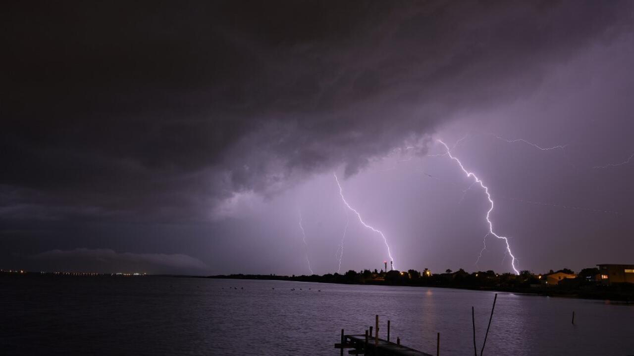
Similar aftershocks are expected in the southeast of the territory, with eight departments on orange alert for potential storms and floods of water.
Météo France pointed out that the towns of Aude, Tarn, Aveyron, Herault, Gard, Vaucluse, Bouches du Rhone and Var have a high probability of experiencing storms with great electrical activity, hail and heavy rainfall.
Between 20 and 50 liters per square meter are expected to fall in less than an hour in Aude and Aveyron; while for Hérault and Gard it is estimated that it could be from 80 to 130 litres. The Prefecture stressed the need to evacuate open spaces.
With EFE, Reuters and AFP
#Torrential #rains #flooding #Paris #alarms #south #France