This 2022 is already the most devastating fire season in at least two decades. According to estimates from the European Forest Fire Information System (EFFIS), adding all the fires that exceed 30 hectares, 193,000 hectares have been burned since January. In six months the fire has swept as much ground as in all of 2012, which was the worst year in the series so far.
The figure of 193,000 hectares means that, from January to today, the devastated area is eight times higher than the historical average for that period. It is an area as extensive as the island of Tenerife, the province of Gipuzkoa or a quarter of that of Madrid. By comparison, last year, as of July 20, 31,000 had been burned. The number of fires is also exceptional: more than 300 have been registered since January, compared to the 83 historical average.
The month of June, with the fire in the Sierra de la Culebra, was a bad month; but July has been even worse. There hasn’t been a month as scorching as this in fifteen years, and it’s not over yet. 112,000 hectares have already been burned, more than in 2021 and in almost any year in the series.
At this time, NASA satellites detect dozens of hot spots in Spain. At this time, fires such as those in Montes de Valdueza (León), Ateca (Zaragoza) or A Pobra do Brollón (Lugo) remain active.
What affects the most is what happens closest. To not miss anything, subscribe.
subscribe
Ateca (Zaragoza)
Condition: active
- When did it start: July 18
- Hazard: Level 2
- Burnt surface: 14,000 ha.
- Cause: unknown
The evolution of this fire has been favorable since Wednesday morning, although its complete stabilization depends on the reproductions that arise in the next few hours being able to suffocate.
Cebreros (Avila)
Condition: active
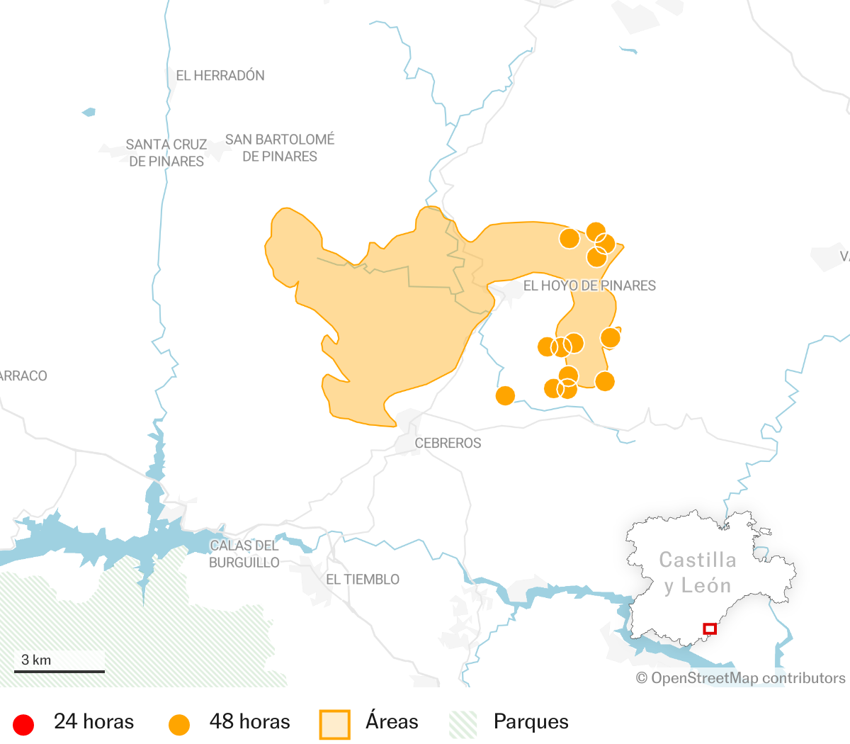
- When did it start: July 16th
- Hazard: Level 2
- Burnt surface: 4,400 hectares
- Cause: a butt
Extinction expectations improved overnight on Wednesday, with some fairly stabilized areas and perimeter zones. The next few hours depend on the behavior of the wind.
To Pobra do Brollón (Lugo)
Condition: active
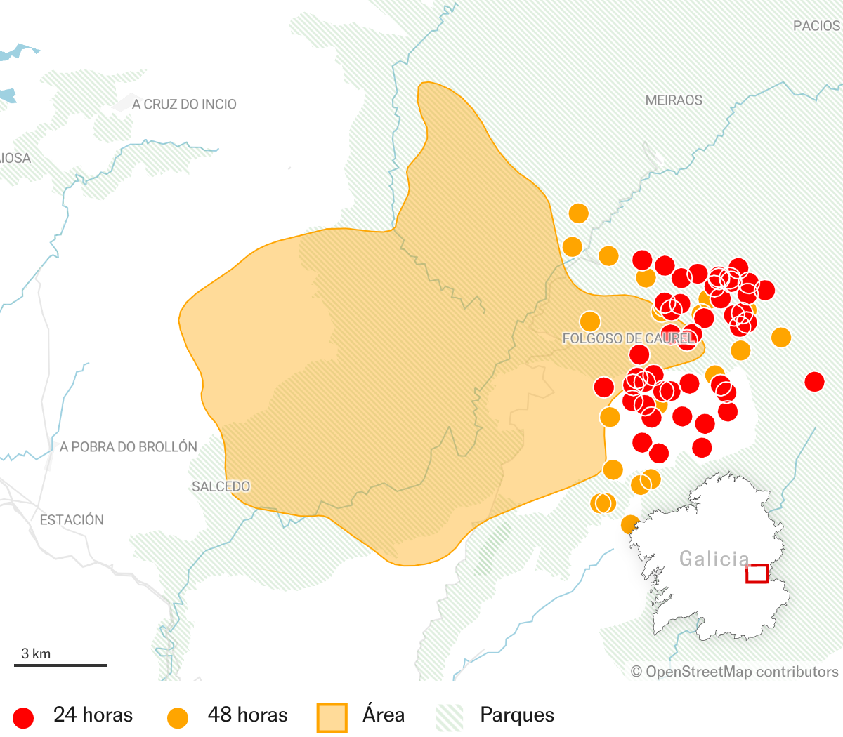
- When did it start: July 14
- Hazard: Level 2
- Burnt surface: 10,000 hectares
- Cause: unknown
The extinguishing services have managed to stop the advance of this fire throughout Thursday. The fire that affects the parish of Seceda, in Folgoso do Courel, where 1,100 hectares have already burned, is also still active and at level 2. The return of part of the more than 900 residents evicted in both locations has already been allowed.
Carballeda de Valdeorras (Ourense)
Condition: active
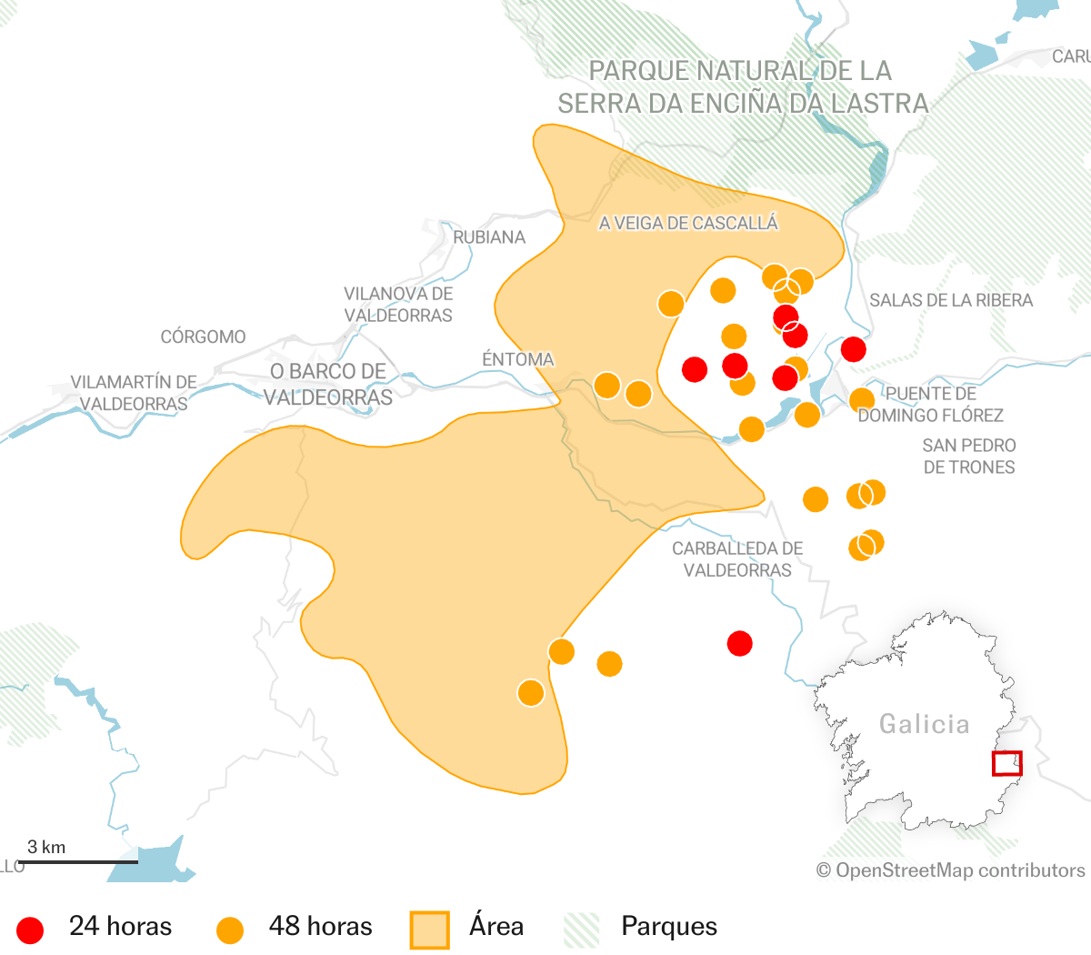
- When did it start: July 14
- Hazard: Level 2
- Burnt surface: 10,500 hectares
- Cause: unknown
It is located near the population center of Candeda and affects the Serra da Enciña da Lastra natural park.
Vilarino de Conso (Ourense)
Condition: active
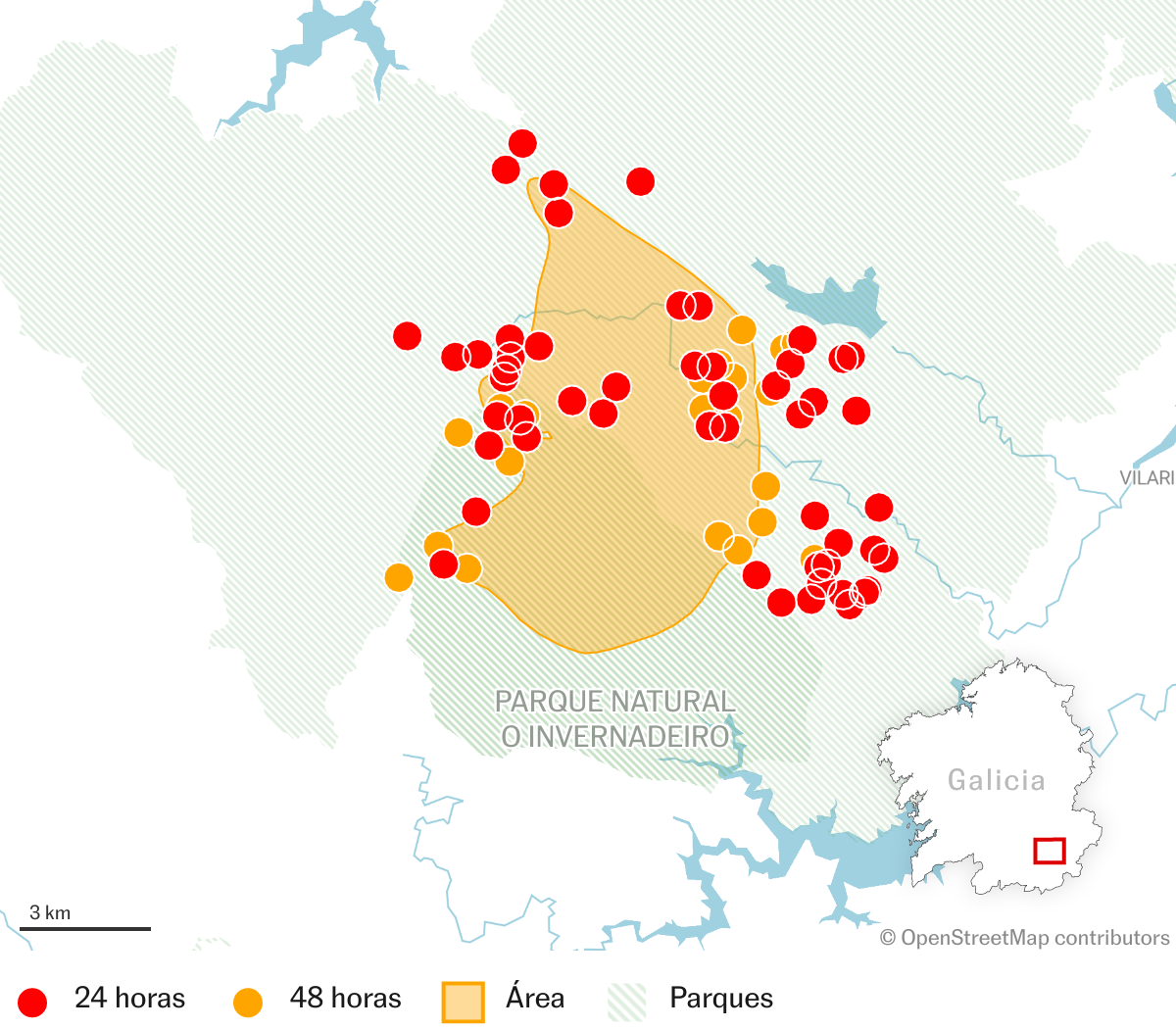
- When did it start: July 14
- Hazard: Unspecified
- Burnt surface: 5,200 ha
- Cause: unknown
Part of this fire is also within the Invernadoiro natural park, where 1,800 hectares had already been burned on Monday.
Valdueza Mountains (Leon)
Condition: active
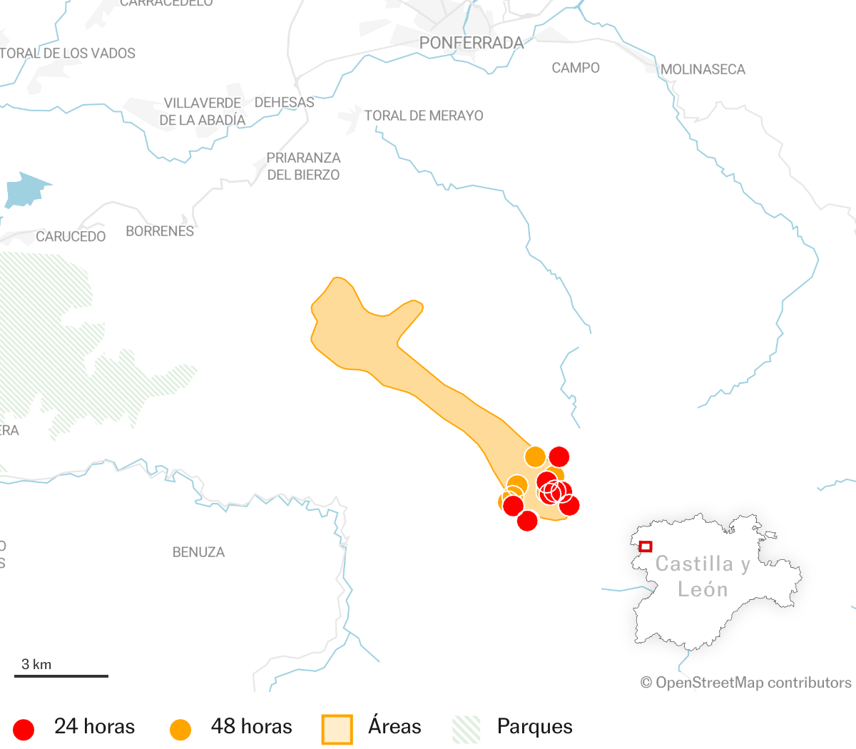
- When did it start: July 17th
- Hazard: Level 2
- Burnt surface: 2,000 hectares
- Cause: unknown
The advance of the flames has forced the eviction of hundreds of residents of the municipalities of Rimor, Orbanajo, Ozuela, San Adrián and Ferradillo. The flames advanced slowly during the night of Wednesday, but the perimeter of the fire complicates the extinction of the different hot spots.
Losacio (Zamora)
Condition: stabilized
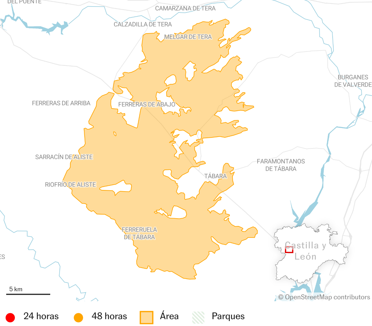
- When did it start: July 17th
- Hazard: Level 2
- Burnt surface: 20,000 ha
- Cause: unknown
The fire has been considered stabilized on Thursday morning, after five days of extinction tasks. The fire has left two fatalities and several injured.
Valdepenas de la Sierra (Guadalajara)
Condition: stabilized
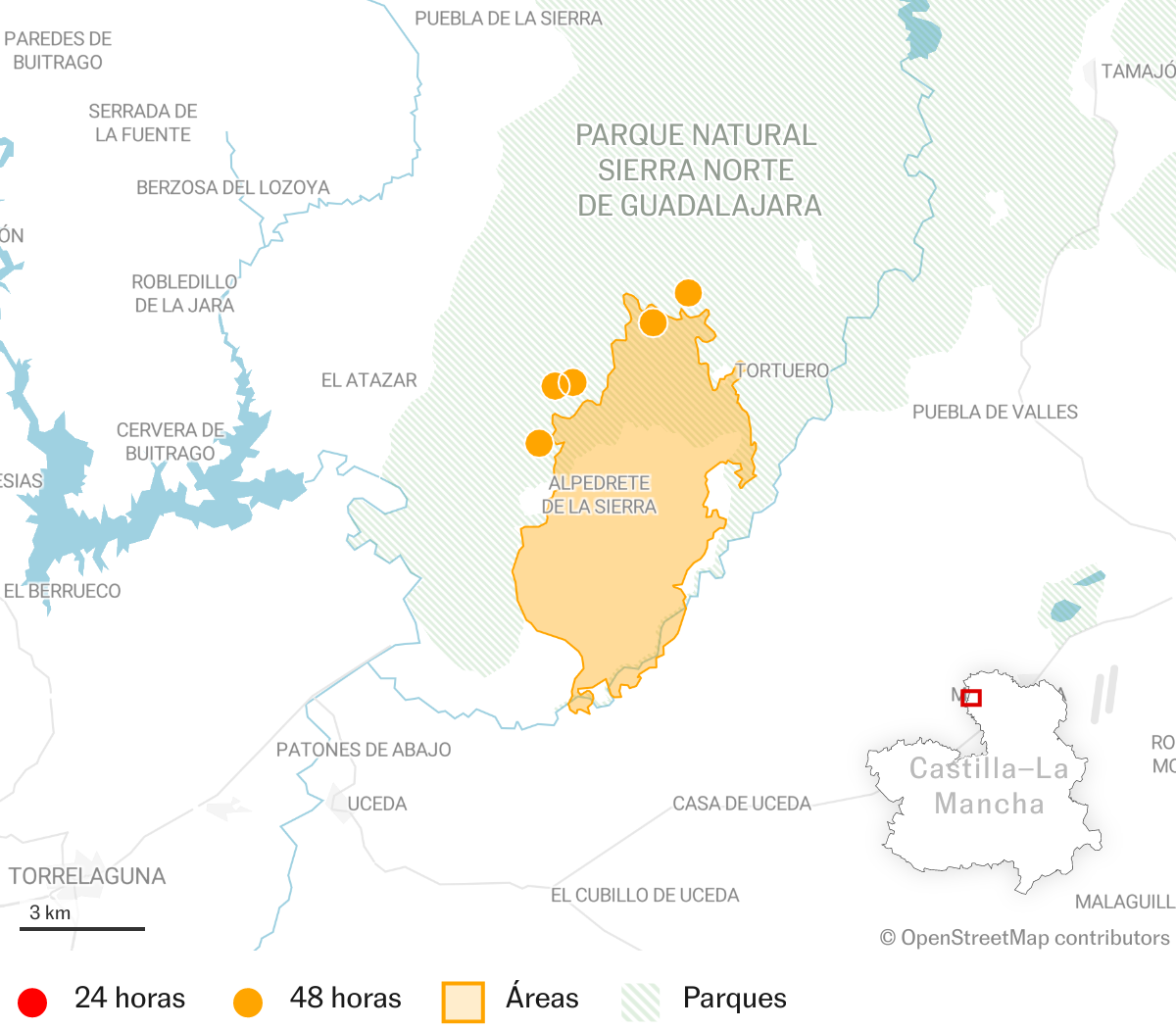
- When did it start: July 19
- Hazard: Level 2
- Burnt surface: More than 3,000 hectares.
- Cause: unknown
This fire, which affected an area with complex orography, was considered stabilized on Thursday morning. During the night of Tuesday, the flames motivated the eviction of more than a hundred residents of nearby municipalities who are already returning to their homes.
Fires controlled or extinguished in recent days
Source and methodology. The figures for the number of fires and hectares burned accumulated each year come from EFFIS, and consider only the fires that affected more than 30 hectares. The perimeters of the most recent fires may change in the coming days as the fire stabilizes. The heat sources of the last 24 and 48 hours are published by the SIGNS, based on NASA satellite data. The burned surface areas for the featured fires is the estimated by EFFIS.
#Map #active #fires #scorching #July #worst #year #century


