
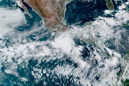
After making landfall around 3:30 p.m. on Monday, Hurricane Agathe It has been downgraded to category 1, as warned by the meteorological services. The area where it has broken into, near San Pedro Pochutla, is close to the Pacific beaches —Huatulco, San Agustinillo, Zipolite or Mazunte— which are among the most touristic in Mexico. The authorities have reported the closure of schools, businesses and also the prohibition of approaching the sea due to the strong waves. More than 200 shelters have been installed throughout the State and both tourists and residents are asked to stay in their homes or in hotels.
The National Meteorological Service has marked a prevention zone for the possible effects of the hurricane from Salina Cruz —to the east, on the Tehuantepec isthmus and almost bordering with Chiapas— to the Chacahua lagoons, west of Puerto Escondido. In this coastal strip that covers almost the entire Oaxacan coast, the hurricane is expected to enter this afternoon. It has also established a broader surveillance zone: from Salina Cruz to Barra de Tonalá, in Chiapas. And a tropical storm prevention zone on both sides: to the east, to Punta Maldonado, Guerrero; and to the west, towards Boca de Pijijiapan, in Chiapas.
The forecast for this Monday is of torrential rains in Oaxaca that will affect the east of Guerrero and the west of Chiapas; They will also reach west of Tabasco, south of Veracruz. Very heavy rains are expected in Campeche, Yucatan and Quintana Roo, where the Riviera Maya is located. The most touristic points of the country, from Oaxaca to the Caribbean, will be affected by the arrival of Agathe.
Meteorological services warn that the rains can generate an increase in the beds of rivers and streams, landslides and floods in low-lying areas of the States affected by heavy rains. On the winds, gusts of 140 to 170 kilometers per hour are expected. And serious waves: from six to eight meters on the coast of Oaxaca; from four to six meters on the coast of Guerrero and Chiapas.
This Monday’s report asks the population to “extreme precautions” in the aforementioned areas, including maritime navigation. The coordinator of Civil Protection of Oaxaca, Óscar Valencia, has indicated this Monday that the entity is prepared and informed: “Everything that is tourism is already suspended, in the municipalities and on beaches they have suggested that all visitors who take shelter and take refuge where they are. We are waiting for people who need help.”
The Federal Electricity Commission released its protocol on Sunday to deal with possible contingencies in the event that the electricity supply is affected by the hurricane. And it announces that 1,324 electricians, 231 cranes and 412 vehicles are prepared, as well as 45 emergency plants, 17 lighting towers and a helicopter. Likewise, they report that special interest is being paid to places such as hospitals, gas stations and pumping systems to give them priority if necessary.
Despite the fact that these potentially affected States and several others know that the hurricane and cyclone season is beginning, normally the country ends up suffering heavily from the devastating effects of these phenomena, due to the rising waters that sometimes isolate entire towns that have to manage in inflatable boats provided by the army, something that is also common in other Caribbean countries, one of the reasons why thousands of people are forced to move and emigrate almost every year.
subscribe here to newsletter of EL PAÍS Mexico and receive all the informative keys of the news of this country
#Hurricane #Agatha #downgraded #category #touching #coast #Oaxaca
Leave a Reply