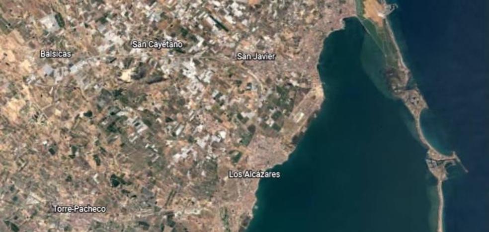
Image of the Mar Menor seen from the satellite. /
Google Earth has a ‘timelapse’ feature that allows you to check the evolution of the state of the salty lagoon
What was the Mar Menor area like 37 years ago? Thanks to Google Earth you can see how it has evolved. The Google application has a new ‘timelpase’ functionality that allows you to see how the territories of the globe have changed from 1984 to the present day.
Thus, with the Mar Menor area, it can be seen how construction has been proliferating around the salty lagoon. And not only that. The most impressive thing is that you can see how the state of the Mar Menor has been changing through the color of its waters. These, which start out as a dark blue color, begin to turn turquoise around 2016, the year in which the situation of the lagoon began to be critical. You can even see what is known as the ‘green soup’, that is, the proliferation of phytoplankton that caused the eutrophication of the sea in 2017 and 2018.

The Mar Menor in 1985 (left) and 2018 (right). /
How to use the Google Earth ‘timelapse’
Users who wish can explore this and other locations in 3D thanks to the images collected by the Landsat and Copernicus satellites.
Using this functionality is very simple. To do this, you just have to access Google Earth and click on the ‘Voyager’ option. Once there you must be patient, since the program will travel to a random place on the map. However, you can change the location in the dropdown on the right. There you can go forward or backward in time, discover outstanding places as well as information.
Fantastic routes around the world from Switzerland to Israel. such as the Highlands of Scotland or the Grand Canyon of the United States.
#Mar #Menor #changed #present #day