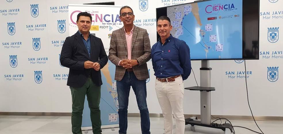
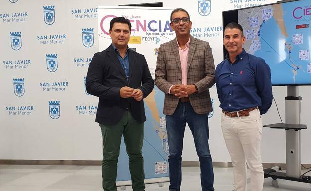
A moment of the presentation of the routes. /
‘San Javier: science by land, sea and air’ is the new itinerary of the MurCiencia project, which already has four routes through the Region
The University of Murcia (UMU) and the City Council of San Javier presented a novel tourist route that will cover different points of the municipality offering information about the science that is hidden in the environment.
Gastronomy, geography or physics are some of the disciplines that can be discovered through the most iconic planes of the Mar Menor. Seven points or stops make up this route, which can be done on foot or by bike, and which will cover the science of the environment from Santiago de la Ribera to La Manga.
The project was presented this Thursday morning at the San Javier Town Hall by the mayor of the municipality, José Miguel Luengo, and the vice-rector for Transfer, Communication and Scientific Dissemination of the UMU, José Manuel López Nicolás. “With this route we intend to tell the science behind the cultural manifestations, heritage and uses of the Mar Menor and offer added value to the wide range of tourism in the area”, highlighted the vice-rector of the UMU.
The press conference was attended, among other attendees, by the directors of the municipal schools, to whom the City Council hopes very soon to be able to offer this route as part of the extracurricular programming of schools and institutes, establishing a strong commitment to science in the school environment. “This proposal will allow students and all the inhabitants of San Javier to get to know the municipality in a different way,” Luengo stressed.
what can be seen
In the four points of Santiago de la Ribera you will be able to see the gastronomy of the area represented with special mention to the pie de cierva, originally from San Javier. Other notable aspects of this route are the science of navigation, the volcanic origin of the Mar Menor, how the typical boats of the area work and how the limits of aeronautics are overcome by the acrobatics of the Eagle Patrol.
Crossing the salty lagoon by ferry, you can enjoy the three points of this riverbank where there is talk of wrecks, ancient sunken ships that are more than 2,000 years old and that attest to the frenetic commercial activity that this territory had in the past. past; the salt mills of Pudrimel and Veneziola and the traditional fishing gear and the encañizadas.
Each of the points will be signposted at street level by a specific poster, in it you will be able to find a QR code that, scanned from any device, will take us to the project page with complete information and curiosities about that specific point supported with interactive games.
The science of the region
This itinerary is part of a global project: MurCiencia, an initiative of the Scientific Culture Unit of the UMU with the collaboration of the Foundation for Science and Technology (FECYT) – Ministry of Science and Innovation. With this innovative proposal, the UMU is promoting a new form of tourism in the Region: scientific tourism.
A bet that challenges Murcians and visitors to look at the city with different eyes, and that offers its routes through the cities of Murcia and Cartagena, as well as an alternative route through the historic center of the capital in which the linguistic landscape can be discovered. and how the passage of different historical events has affected the particularities of our vocabulary.
All the information about each of the routes and the points of the itinerary can be found on the project’s website: https://www.um.es/en/web/murciencia/
#UMU #creates #tourist #route #discover #science #hides #Mar #Menor


/s3/static.nrc.nl/wp-content/uploads/2023/10/web-2910culmartinbossenbroek.jpg)
