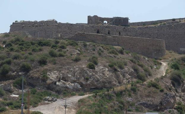
Archive image of the Castle of the Moors. /
The Cartagena City Council has created a sea route through the Santa Lucía neighborhood so that tourists and visitors can learn about the history of this place to which the Romans gave special importance due to its strategic location next to the sea.
The first references to a town in Santa Lucía date from the second century BC, located in the surroundings of Almarjal. Two thousand years later, a plan-guide has been edited and four monoliths in the shape of a lateen sail have been installed at different points to make known from its origins as an enclave linked to the fishery to the Valarino family’s glass factory, from the 19th century , including the history of the Castle of the Moors, built in the 18th century for the defense of Cartagena.
The councilor delegate for Sustainable City and European Projects, Cristina Mora, explained that with this route “it is intended to help the preservation of the historical and cultural, marine and fishing heritage, revitalize the economy of the neighborhood, as well as the empowerment of indigenous elements and differentials of Saint Lucia and the Mediterranean ».
The route has been financed thanks to the Participatory Local Development Strategy of the Local Fisheries and Aquaculture Action Group of the Region of Murcia (Galpemur). 85% of this financing comes from the European Maritime Fisheries Fund (FEMP) and 15% from funds from the Autonomous Community.
The signage that tells visitors the history of the neighborhood has been installed around the Paseo del Muelle, Pinacho, Plaza de la Isla and Calle Santiago, among other places.
.